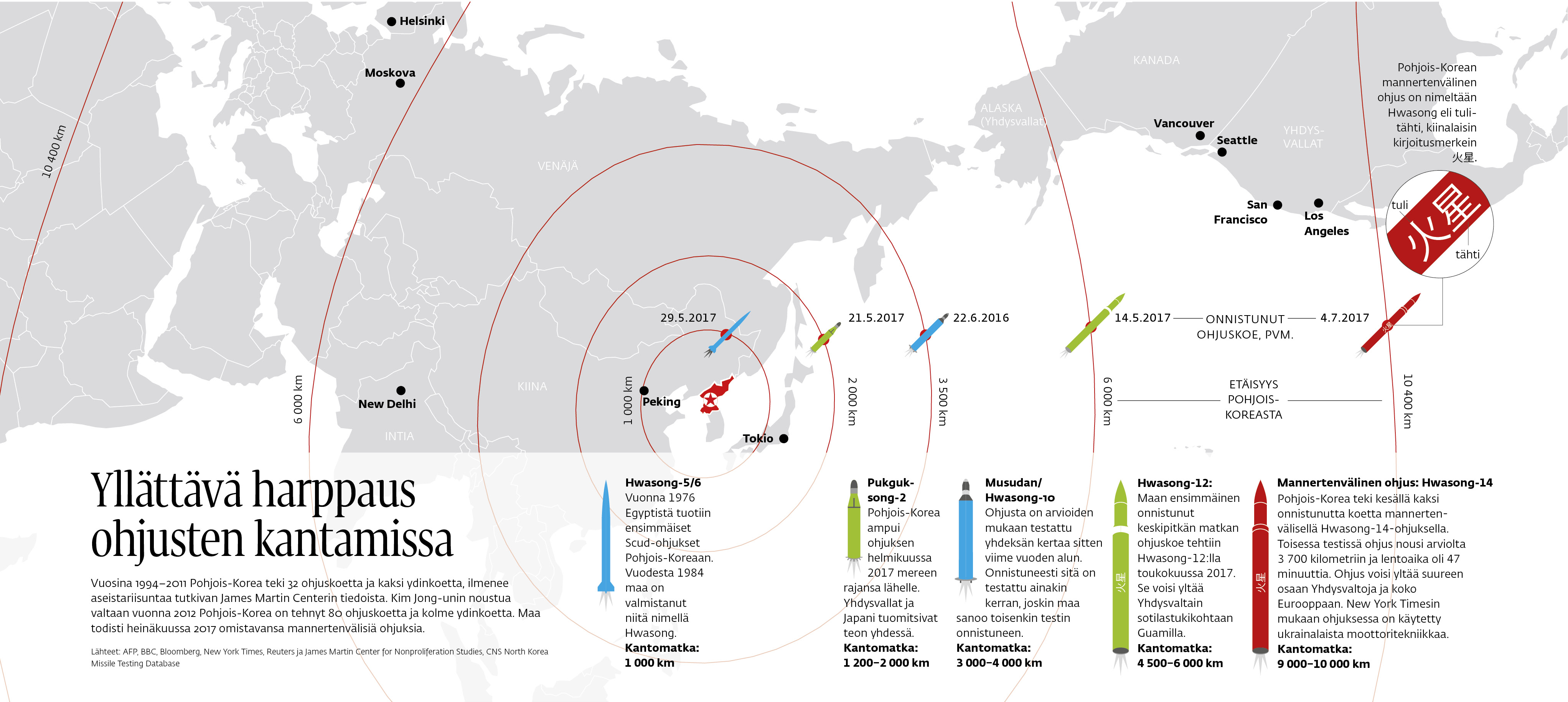
“A sudden leap in missile ranges” is the title for this magazine infographic from 2017.
In the summer 2017 the world observed the expanding missile capacities of North Korea. This full spread print infographic illustrates the missile ranges of missiles known to have been tested y the country. The infographic was published in the magazine Ulkopolitiikka, a quarterly on foreign affairs published by Finnish Institute of International Affairs.
Method: the map projection was created and the missile ranges calculated with the d3.js library. This gave a svg that was edited for print in Adobe Illustrator. The infographic follows the Ulkopolitiikka style guidelines. The data was collected by journalist Niko Vartiainen.
KRUT Information designer Julius Uusikylä also contributed to the UI design of the Ulkopolitiikka online magazine.
